
Toronto is one of the most beautiful and comfortable cities in Canada. Nature and infrastructure are harmoniously combined here and local residents and tourists lead an active and healthy lifestyle. Many of them start and end their day with a run. This is a great way to keep fit and see the city in all its glory from different perspectives, as well as visit new amazing places. The main thing is to choose a running route. Learn more at itoronto.
The Route along Toronto Islands Trails and Bridges
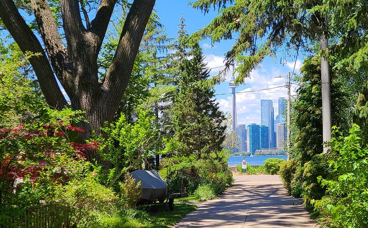
The Toronto city centre is washed by Lake Ontario, which features numerous islands. They are a picturesque corner of nature in the middle of the metropolis and an ideal place for a run! The islands appeared in the middle of the 19th century as a result of the landscape change and the splitting of the large peninsula. In the 20th century, local residents began to arrange them and turned them into the largest pedestrian zone in North America. Its total area is 230 hectares.
Locals call this place Toronto Island Park because it consists of 15 islands. All of them are connected by bridges and paths. They pass along the lake, sports areas, yacht clubs, grass fields, picnic areas and attractions. Taking up this jogging trail, you can see not only local recreation areas but also the metropolis before your eyes.
If you want to get there, you can take a 15-minute ferry ride from Jack Layton Ferry Terminal at the foot of Bay Street and Queens Quay. The ferry arrives at one of three locations, which connect the islands. From each of them, you can run along the paths to the pier. It leads to the centre of the Island Park. You can also cross bridges and visit the small islands nearby.
The 4 km-long Route along the Central Waterfront
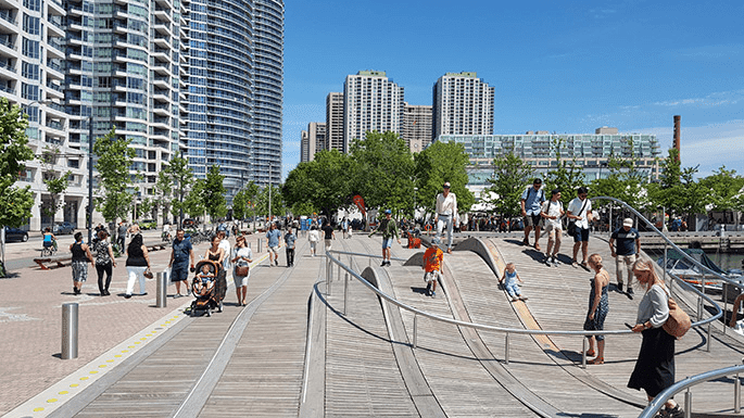
It is one of the most beautiful routes in the world! This place underwent reconstruction in 2007. Since then, the Waterfront has changed significantly and has become the most popular place for jogging in downtown Toronto.
Running along the Central Waterfront is not only comfortable but also fascinating. On the way, you can see many different unusual architectural novelties, recreation areas and playgrounds for children. It also offers great views of Lake Ontario and the Fashion District with its many shops, cafes and malls.
Everyone who wants to have a run and open-air recreation by the water comes here. This place features a marina, many trees and residential buildings. Toronto Central Waterfront offers a 4 km-long jogging or walking route that goes up and down like sea waves.
The Route along the TOP 5 attractions in downtown
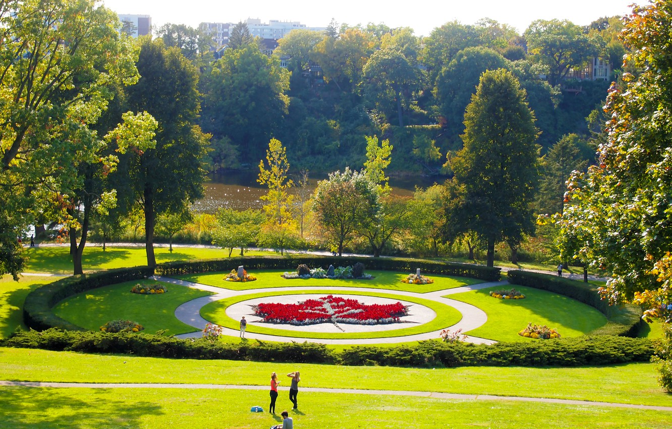
A run in the very centre of the metropolis is a great alternative to a city tour. Thus, you can not only recharge your energy and get stronger but also come across some historical spots. You can start your route from different locations. For example, the entrance to Queen’s Park, which is made in British style, can be a perfect starting point. There are many tall trees, lawns for picnics, the statue of Edward VII and the Legislature Assembly of Ontario. Therefore, this place will be interesting for everyone.
This area is not only a green zone but it also houses the Government of Ontario. That’s why it was given the name of the Queen’s Park. Nearby, there are two more attractions, Victoria College and the University of Toronto, which were built at the beginning of the 19th century. Their architecture with Gothic facade, old gables and stained-glass arrow windows impresses at a glance.
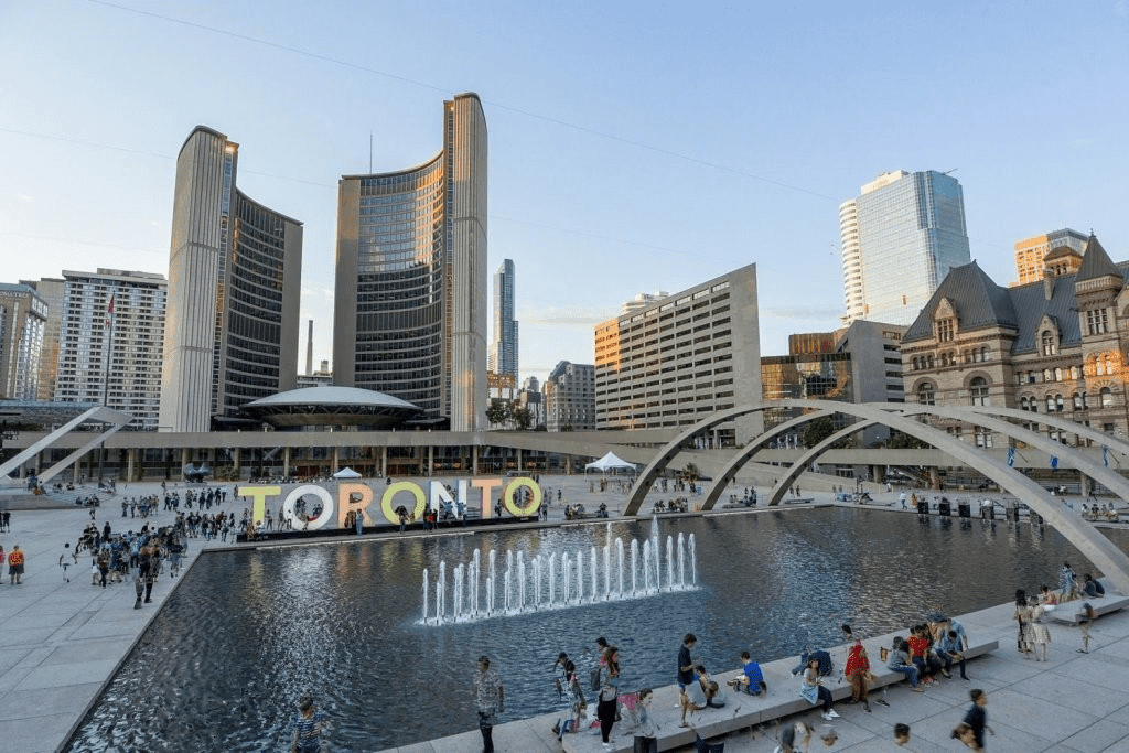
Each educational institution looks like a fairy-tale castle and the surroundings are very spacious and picturesque. Running farther, you can see the green fields, which are crowded with students, and the TV tower. If you continue to follow the route, you will reach the Toronto Central Waterfront. There is a dock where you can stop to have a rest and then continue running to the central square. Then you can head to the nearby Hockey Hall of Fame and run straight down Yonge Street. That’s how you can get to downtown Toronto in 15-20 minutes. Here, you can find a skating rink, the City Hall and an art object in the form of the name of the city.
The Route through Toronto Parks and the Lake Ontario Waterfront via the Martin Goodman Trail
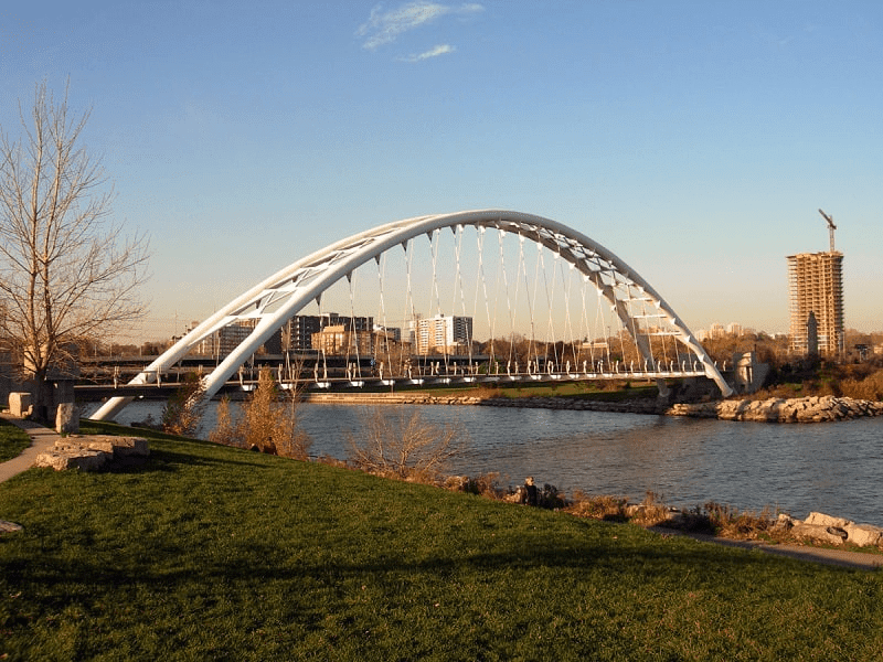
If you want to get a view of Toronto from afar and have an open-air run, you can take the Martin Goodman trail. It is named after the president and editor-in-chief of the Canadian daily newspaper Toronto Star. The trail comes along the entire shore of Lake Ontario. It is a 56-kilometre route that runs along the Toronto Waterfront. The full trail takes a few hours. It would be better if you take it in good weather if you want to admire the beautiful views of the city.
This trail was opened in 1984 and then it was expanded. In 2005 it was laid to the Harbour East Hedland, and in 2009, a new section of the road was built along Lake Shore Boulevard. Thus, it is a part of the parkland, which connects several parks, namely Humber Bay Shores Park, Humber Bay Park East and others. Following the trail, you can visit any of them. Locals call the trail one of the best spots for bird watching and Waterfront recreation.
The Route through High Park to Humber Bay
Sometimes you want to have a run in natural surroundings or by the water and relax from the active rhythm of life in the city. An ideal choice is the largest park in Toronto, which leads to Humber Bay. The park appeared at the end of the 19th century. Then this area of 161 hectares was bought by local architect John Howard.
Before his death, he left a will in which he gave those lands to the city authorities. There was a condition that they should become a park area that will never be built on. That’s how High Park was created in Toronto. It is very easy to get there. You just need to cross the intersection of Kennedy Avenue and James Street and then turn right.
Here, you can often come across squirrels, coyotes and chipmunks near oaks, cherry trees and shrubs. In addition to amazing nature, there are several ponds, sports grounds, theatres, swimming pools and even a zoo. Thus, a run through High Park will be an exciting journey for everyone!
Also, if you wish, you can continue running to the Colborne Lodge museum and then cross two more intersections. There are trees along the shoreline and Humber Bay behind them. Then you can continue your route along the by-the-water path.
The Route through Scarborough, the Toronto district with cliffs, rocks, parks and beaches
This district appeared in Toronto’s eastern part in 1954. An interesting fact is that it acquired the status of a city in 1983, as its population has grown significantly over 200 years.
This area is very popular not only among Torontonians but also tourists. They come here by car or public transport to have a walk in the natural surroundings and see the local attractions, the cliffs of the Scarborough Bluffs, the lake and Rouge National Urban Park.
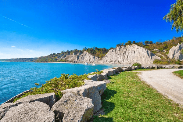
You can start the Scarborough Trail on Kingston Road, which is located next to Toronto’s Orchard Park. It passes through the entire district and goes by the water. If you turn left to Markham Road, you can reach the bluffs. There are eight parks and 15 kilometres of beach, which are the best places for jogging and recreation all day long! Here you will find beautiful views of the cliffs, the lake, landscapes and winding paths. Having visited such a beautiful place, everyone will get unforgettable memories and inspiration.